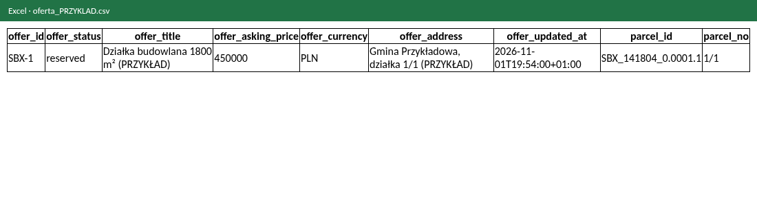
The simplest integration – no developers needed. Download the full dataset from any report or the offer list and open it in Excel, Google Sheets or LibreOffice, or import it into your broker database.
Use cases
Small agency: weekly offer list in Excel
Valuer: parcel parameters and boundaries into a spreadsheet
Privacy: the owner is always ***, land-register persons are masked, no data from KW sections III/IV (mortgages, encumbrances). KW is fetched only from a number you provide. Pricing is display only; online payment for integration plans is in preparation. See pricing →
File tools – see them on a real report
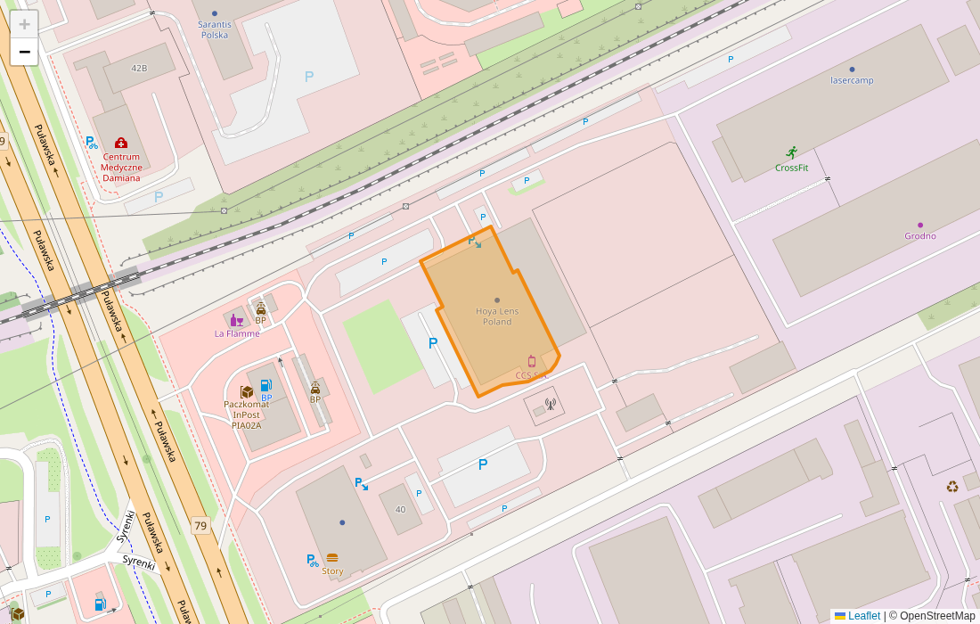
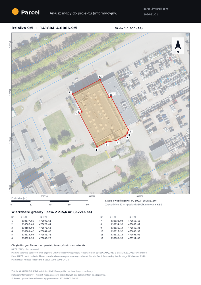
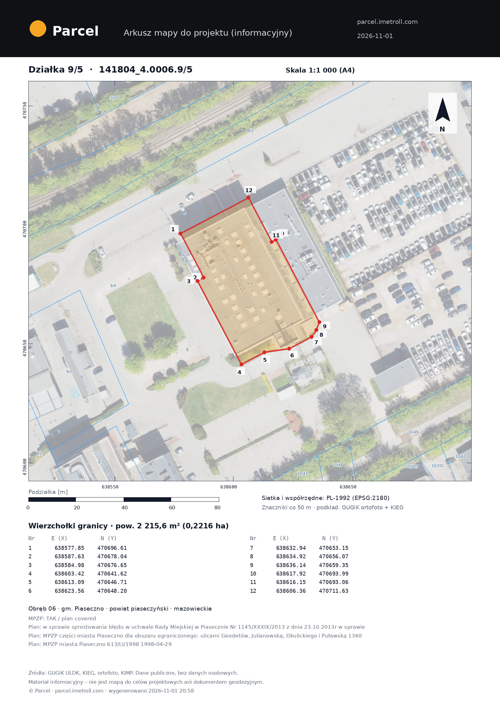
All files below are real exports from the demo report (Piaseczno, parcel 9/5). The API sandbox is free for everyone. Full integrations and file tools are included in the subscription from 69 PLN, and for Agency agents in the Studio and Agency plans.
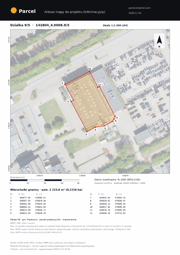
Agency agent: you create the offer and attach the Parcel PDF map, a DXF plan for the client’s architect and a ready parcel description.
The buyer gets facts: boundaries, zoning plan, distances – instead of “plot close to the centre”.
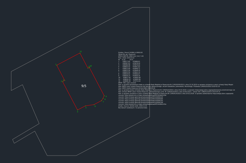
DXF – parcel plan for CAD
Boundary, numbers, vertices, neighbouring parcels, coordinate table and description (layers). Opens in AutoCAD, ArchiCAD, BricsCAD and QGIS. PL-1992 or PL-2000. For architects, surveyors, designers.
Open the parcel report → “Export”.
Choose DXF and the system (PL-1992 or PL-2000).
Open in CAD – layers GRANICA, NUMER, WIERZCHOLKI, SASIEDZI, TABELA, OPIS.
Agent: attach the DXF to the offer or send it to the client’s architect.
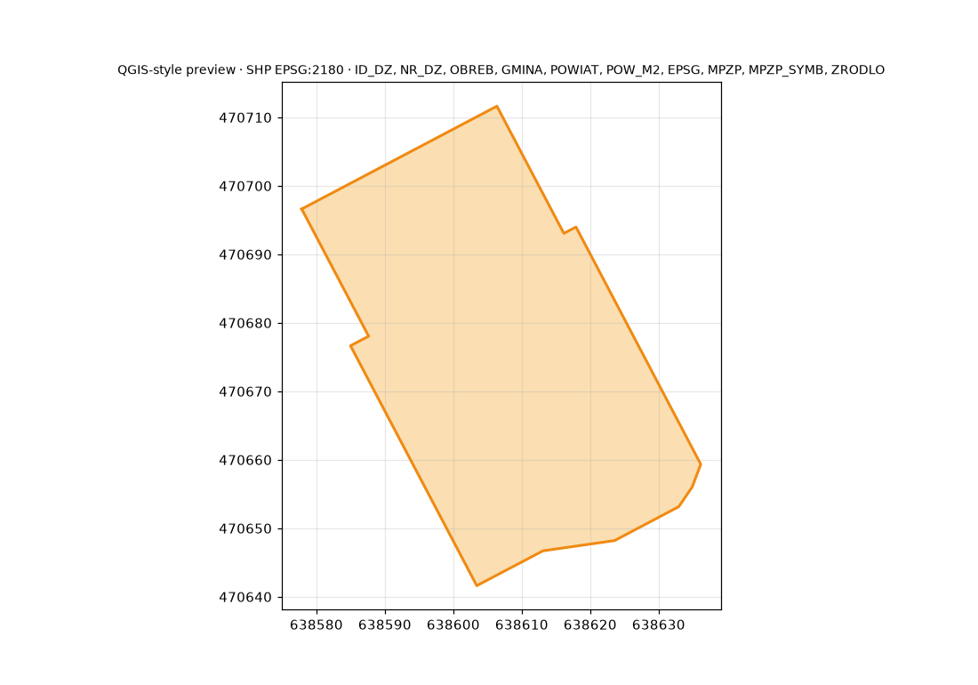
SurveyorGeoJSON, SHP or DXF in PL-2000/PL-1992 straight into surveying software – a faster start on the design map.
ArchitectDXF as a base in ArchiCAD/AutoCAD + zoning plan information (resolution, drawing) from the report.
Civil / road engineerAccess and surroundings, nearby utility networks (GESUT, informational), PDF/PNG maps for investor presentations.
Investor / developerConsistent reports and CSV/JSON data for several plots – easy comparison of area, zoning and distances.
Bank / valuerPDF report and scaled A4 map as an attachment to the analysis – no mortgage or encumbrance data.
Private buyerLooking for a plot yourself? The PDF report and map show boundaries, zoning and distances before you go to a viewing.
MunicipalitySHP and GeoJSON for the GIS system – parcel layers with attributes.
What fits in an agent’s offer description
Parcel no. 9/5, Piaseczno commune (powiat piaseczyński, mazowieckie). Area approx. 2215,6 m² (from cadastral geometry, indicative), boundary with 12 vertices – boundary map and orthophoto attached.

Zoning: the parcel lies within a local zoning plan (MPZP, resolution 1312/XLIII/2014 of 2014-02-12). Permitted use and building parameters – see the plan drawing and text (link in the report).

Surroundings (straight line): bus stop Lamina 04 – 201 m, shop Netto – 505 m, clinic – 167 m, school – 693 m, pharmacy – 706 m, kindergarten – 883 m.

Utility networks nearby (GESUT, informational): water, sewer, gas, power, telecom, district heating.

Downloads: DXF parcel plan (AutoCAD, ArchiCAD) and the full PDF report: https://parcel-staging.imetroll.com/demo/
Text from real demo report data. The report has no sunlight or terrain-slope data – we do not include it.
We use only necessary cookies (login session, your cookie choice). We do not use analytics or advertising cookies. Cookie policy